Flutter Map · location and route exploration
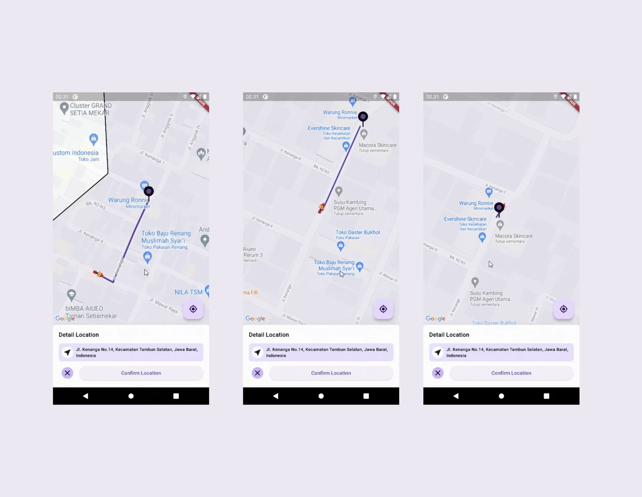
A Flutter mapping app exploring location tracking, service-area boundaries, and route visualization. It combines Google Maps with geolocation, address lookup, and route polyline handling.
Open projectA Flutter mapping app exploring location tracking, service-area boundaries, and route visualization. It combines Google Maps with geolocation, address lookup, and route polyline handling.
A Flutter mapping app exploring location tracking, service-area boundaries, and route visualization. It combines Google Maps with geolocation, address lookup, and route polyline handling.
Open project



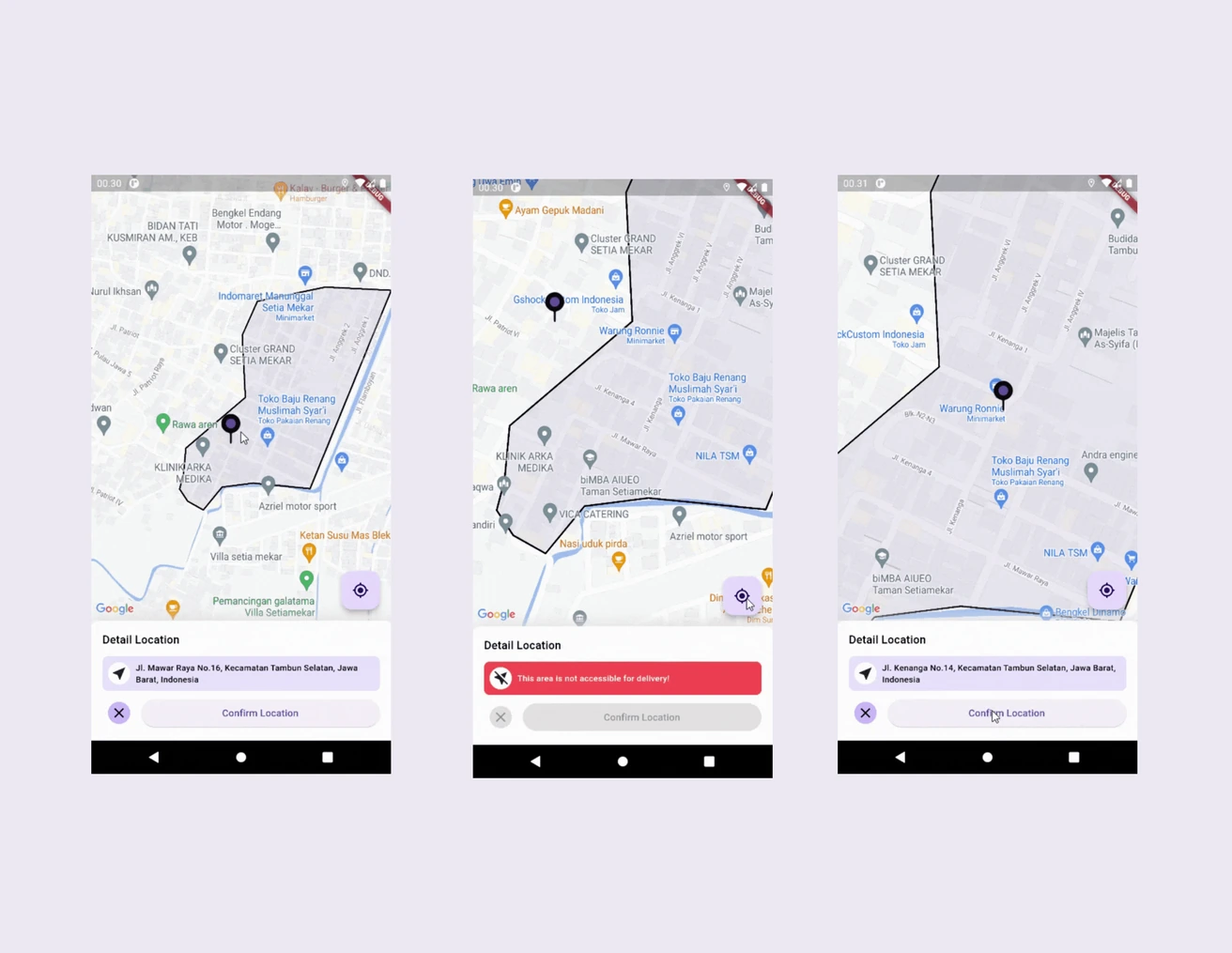
Flutter Map explores how location data can be used to define service areas, identify current positions, and visualize routes within a mobile application.
Built as a learning and research project, the application brings together Google Maps integration, device geolocation, address lookup, and route rendering in Flutter. The focus is on understanding how these capabilities work together to support location-aware workflows.
The application supports defining a reachable area using geographic coordinates. A point-in-polygon check based on the ray casting algorithm determines whether a location falls within the configured boundary, providing a foundation for area-based delivery workflows.
Route coordinates are retrieved using the Flutter Polyline Points package and rendered as map polylines. The implementation supports driving directions between origin and destination coordinates, helping visualize routes for navigation and shipment-related scenarios.
Using Geolocator, the application checks location-service availability and handles location permission requests before accessing the device position. It also uses Geocoding to translate latitude and longitude coordinates into a readable address.
Google Maps Flutter provides the map interface, while dedicated helper methods handle camera movement, geographic boundary checks, address retrieval, and route coordinate processing. This separation keeps common mapping operations reusable across the application.
A closer look at the interfaces, workflows, and details behind the work.
Explore more projects, discover new ideas, and see what else I've been working on.
A Dart CLI that discovers Indonesian food, drink, snack, and lifestyle promotions, then filters, deduplicates, and summarizes results with source links and social buzz signals delivered through Telegram.